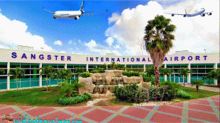
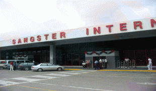
Sangster International Airport (Sangster International Airport)
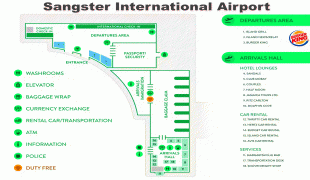
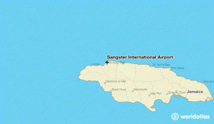
Sangster International Airport is an international airport located 3 mi east of Montego Bay, Jamaica. The airport is capable of handling nine million passengers per year. It serves as the most popular airport for tourists visiting the north coast of Jamaica. The airport is named after former Jamaican Prime Minister Sir Donald Sangster.
The airport is run by the management company, MBJ Airports Limited, whose leading stakeholder is Grupo Aeroportuario del Pacífico, and minority-owned by Vantage Airport Group. Sangster was privatised and turned over by Airports Authority of Jamaica to the consortium in 2003. A 2021 study found that Sangster International Airport was one of the top 20 most vulnerable international airports to climate change caused sea level rise.
Sangster International Airport in Montego Bay, St. James, was first conceived in 1936 when the site now housing the Sangster International Airport was identified as one suitable for the construction of an airport in the town of Montego Bay. Originally named the Montego Bay Airport, a decision was made to build the runway in 1940, and the actual construction of the facility was completed on 18 February 1947. At the time of its completion, the town of Montego Bay was more like a playground for the rich and famous, and was considered then, one of the premier vacation spots within the Caribbean, just as it is today.
The first international airline to fly into the Montego Bay Airport was Pan American Airways (which eventually became Pan Am), and the airport, which in comparison to today's standards, was more like a small aerodrome, was operated by Pan American until 30 September 1949, when the Jamaican government took control of the facility. However, the Sangster International Airport, as known today, is nothing like it was in the early days. One of the most noticeable differences was that initially, the terminal building was on the northern side of the runway but was shifted to the southern side of the runway during one of the several upgrading exercises that took place at that facility, which was necessitated by the growth in air traffic over the years. Plans for the construction of a new terminal at its present location, on the southern side of the runway, were announced in July 1955. the plans for the new terminal building was part of what turned out to be a continued upgrading and restructuring of the facility, to enable it to cope with the growth in traffic. The original terminal was built and opened on 7 July 1959, with a capacity to accommodate 500 passengers per hour, and parking for seven aircraft at a time.
| IATA Code | MBJ | ICAO Code | MKJS | FAA Code | |
|---|---|---|---|---|---|
| Telephone | Fax | ||||
| Home page | Hyperlink |
Map - Sangster International Airport (Sangster International Airport)
Map


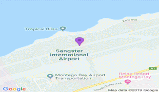
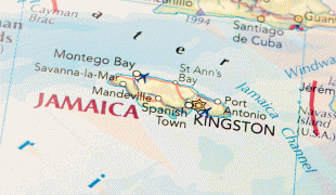
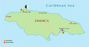

Country - Jamaica


Currency / Language
| ISO | Currency | Symbol | Significant figures |
|---|---|---|---|
| JMD | Jamaican dollar | $ | 2 |
| ISO | Language |
|---|---|
| EN | English language |